Jeff Roehm is one of NCLC’s most active volunteers. He splits his time among Portland, where he has lived most of his life; Manzanita, where he has a second home; and Seaside, where he grew up and where he serves as site steward for five NCLC properties in the Neawanna estuary. Occasionally he contributes essays to this People Plants Wildlife blog. Here he overtops his boots and takes a walk down memory lane in a ramble through the “Little Neawannas.”
The other day I was getting ready to head back over the pass to Portland when I saw a patch of blue sky. That was all I needed on a rainy day in February. It was time for my winter visit to Salmonberry Knoll, one of the five NCLC properties I’ve been visiting since 2012 that we now collectively call the “Little Neawannas.” I drove over to the softball field parking lot, put on my boots and hat, headed down the west shoulder of Wahanna Road, past the trash, and waded into the swamp.
Salmonberry Knoll is a tiny little place by any comparison, just four acres. But it seems much larger since it’s surrounded on all sides by other open land. It’s almost impossible to get there from anywhere else without a major bushwhack. One big obstacle is Coho Creek, which is actually a ditch that was dug long ago to help two dairy farms dry out their pasture. Over time it’s become a little bit creek and a little bit ditch that runs under Wahanna Road and empties into Neawanna (formerly Wahanna) Creek. You can wade across in a couple of places, or if you’re out in the open marsh you can jump. The creek out there is a big ditch about three or four feet deep, depending on the tide. Every year the jump seems to get a little wider.
Winter at Salmonberry Knoll
But today I would first have to find my usual spot to ford Coho Creek, then make my way through a maze of trees, brush, and marsh plants out into the open, and finally head south through a gauntlet of channels and holes, some covered by a thin veil of grass à la buffalo traps. In case this sounds easy, I should warn that the last time I led a group to the other side of the creek, we lost two volunteers. Well, not exactly “lost,” but they did slip gracelessly down into the muck and mire of Coho Creek, which is not what they had signed up for.
Today the creek seemed a little deeper in rainy February as I scrambled up the other side into a Seaside no-man’s-land, an area more or less off the charts, owned by the city and separating two NCLC properties, Wahanna Marsh and Salmonberry Knoll. On the Clatsop County Webmap this area is labeled “Neawanna Natural History Park.” That title might be a stretch. The city did have a task force on creating such a park that met and filed a report back in 2000. Since then there’s been some progress toward this goal, but any actual park of that description is still a long way off. It’s a great goal for sure, since the Neawanna estuary runs the length of Seaside and is mostly still intact, particularly at the south end where I am now.
The most significant progress in that direction I can think of is the creation of seven nature reserves and two conservation easements in the estuary. All are managed by NCLC, all monitored by NCLC staff and volunteers. I might be biased, but the key to this being anything like a natural history park is the careful monitoring done by these people who, over time, get to know the land where they walk, season-to-season and year-to-year.
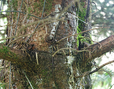
Not-our-tree in the Natural History Park
A good example of my point happened a few years ago right here along Coho Creek. Up until then I’d never walked through this part of the swamp. It’s not our land so not on my required route, and it was just easier to jump the creek/ditch out in the marsh on my way between our two properties. But for some reason, back in the spring of 2016, I walked through here. At once I noticed some trees that had been planted along the creek with wire wildlife baskets around them to protect them from the deer. These plantings were at least twenty years old, long-forgotten, with their wire baskets still in place. By now the wires were cutting into the bark and, in many places, were embedded in the wood.
About a week earlier I’d talked to Katie Voelke, NCLC Executive Director, about this exact situation, probably because I’d seen something out of the corner of my eye. Based on that meeting, I decided to put these trees in my report, complete with photos. Then, in true NCLC style, things started to happen. Project Manager Amy Hutmacher came out with me and took a look. She then contacted the Necanicum Watershed Council and the Seaside Tree Committee. Ten months later I led two work parties of wonderful people armed with wire cutters. As a result, on two very wet and muddy days, once in February and again in April, 121 trees got to breathe free. The trees didn’t know they weren’t on NCLC land. They’d seen my hat with the logo and knew help was on the way. To a tree, ten months is just the blink of an eye.
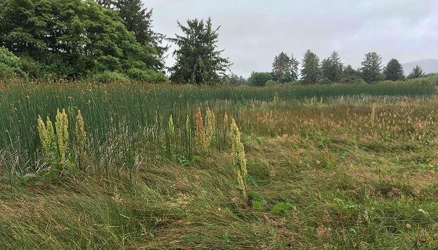
Hardstem bulrush with western dock
That was then, and this is now. I always check these trees on the way through, and today they look pretty darned good, if I do say so. They’ve stopped bleeding sap, and the scars are healing to the point where if a person hadn’t spent two days cutting wire from them he might not even notice. What I did notice, though, was the seventeen trees we didn’t get to, and the piles of wire still left here. Like most things, you’re never quite finished. I left the trees and walked out into the open marsh next to Neawanna Creek and then turned south toward my goal for the afternoon.
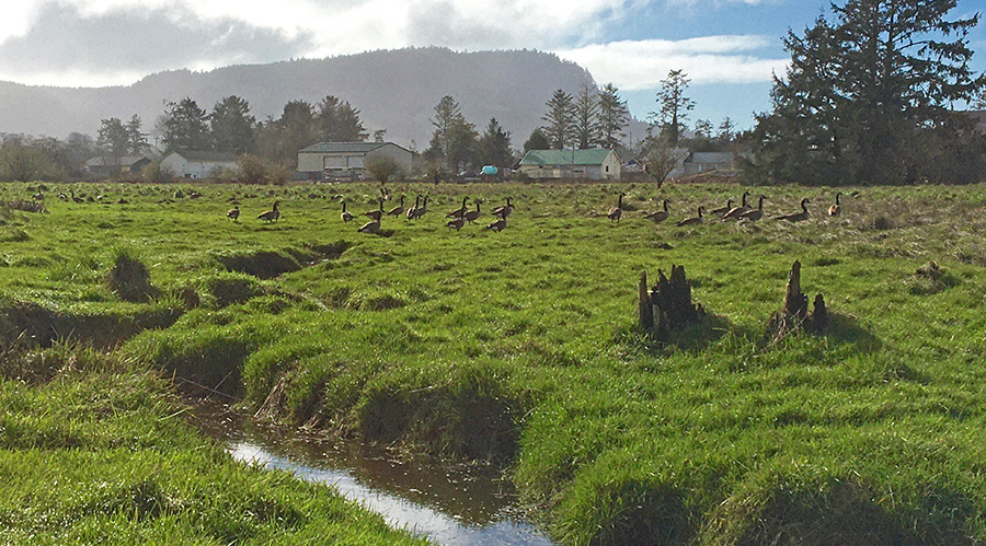
Up ahead I could see the ancient fence posts that mark the north boundary of Salmonberry Knoll Habitat Reserve. There were about fifty Canada geese grazing away on the winter grasses. I actually tried to count them. Up above them loomed Tillamook Head off in the distance. The description of this reserve says that it was donated fee title from Salmonberry Knoll Associates, the owners of all those apartments up on the hill over there. Well that’s not very interesting, and it doesn’t really tell the story either. The truth of the matter is that this is a tidal estuary that, for most of the last century, was used as farm pasture. The Salmonberry Knoll reserve, marked by fence posts and ditches on the north and south boundaries, was the bottom land of a small dairy farm owned by Oney and Ida Honkanen, beginning sometime before 1920.
I feel really connected to this place. Many of my classmates in Seaside, where I grew up, were the grandchildren of the mostly Finnish farmers out here. The land to the south, just over that fence, was farmed by Herman and Milga Mannila, whose grandsons John and Dick were friends of mine. The Alto (Aaltinen) boys, John and Jerry, were down at the end of the road. We used to swim in Neawanna Creek right over there, just south of the bridge on Sundquist Road (Avenue S). Heck, my brother and I were altar boys lighting the candles when Sandra Honkanen married Jerry Boyer in about 1954.
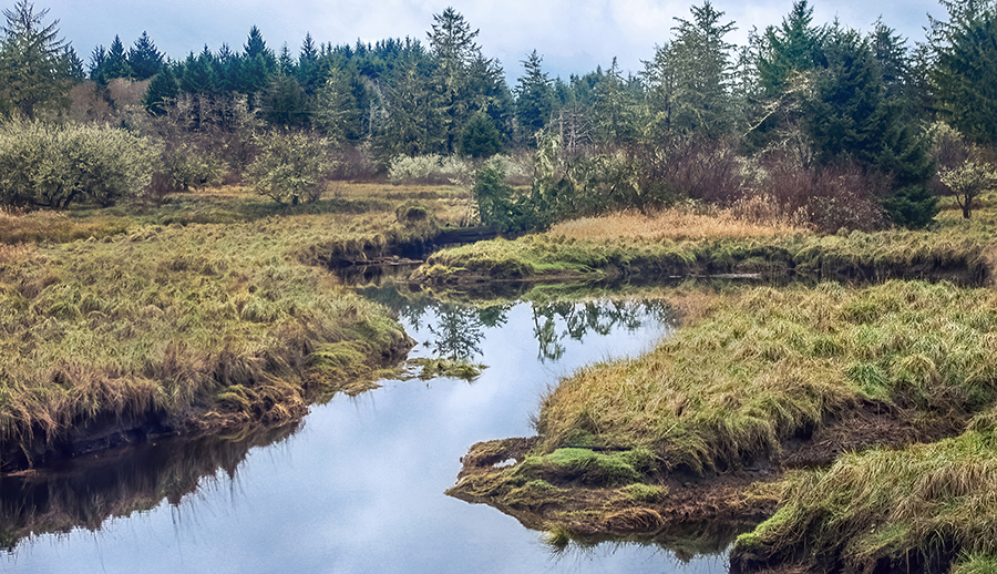
The swimming hole south of the bridge
The Honkanens didn’t live here exactly. They had a house over in what was called Finntown, just on the other side of Neawanna Creek. According to local history, in order to get to his daily chores, Oney Honkanen built a footbridge on pilings over the creek. Today I looked over to the west toward the main channel of the creek. To do my site steward thing I really don’t have to walk over there. I can see all the way to the creek, which marks our west border, then across the creek and into the ghosts of Finntown. There’s a big side channel between here and there that exposes what remains of some old pilings down in the mud. You can’t actually see the main creek from here as it’s hidden from view by the grasses and sedges of the open marsh. Last summer, after eight years coming out here, I finally decided to walk over and take a look.
Once I got out on the other side of the channel, I could see more pilings that headed straight east across the entire marsh starting at the creek. All in a row, they looked like the remains of a raised walkway. Then when I finally got to the bank of the Neawanna, there it was: Oney Honkanen’s footbridge, now just a line of very old pilings out in the creek. There was no footbridge when I was a kid, so the actual bridge has been gone for at least seventy years! Honkanen Farm; sounds like a perfect place for these geese to hang out. I couldn’t resist.
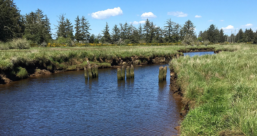
The Honkanen footbridge
But that was last summer. Today I’d decided to do a survey of English holly trees that hide inside the fabulous spruce, alder, and crabapple forested wetland that lines the east side of this marsh. So I walked on across the open (emergent) marsh to the south fence. This place is really a hidden gem. Of all the NCLC reserves I’ve walked, this one seems the least affected by human mischief. Except for these old fence posts and the remains of the footbridge, it’s hard to imagine this was once a farm. There are no invasive plants to speak of, and with all these holes and channels, just where did those cows step? Instead it’s home to probably the largest colony of hard-stem bulrush in the county, plus a bunch of other stuff (seawatch angelica, slenderbeak sedge, and more), plants that were here long before we were. And then there’s the forested wetland that runs across the east side of this place. This is where I headed.
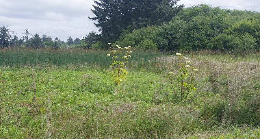
Seawatch angelica, hardstem bulrush, crabapple, and more
I’m not sure how many of you have ever attempted to walk around in what we call a forested wetland here in Clatsop County. The local native tribes, the Clatsop and Tillamook, certainly didn’t do it. They kept mostly to the waterways and beaches. Let’s face it, you can’t really walk around in here. But by my records, this is my 34th trip out to Salmonberry Knoll since I started doing this. So by simple trial and error (and a good memory) I can actually pick my way through this, at least far enough to put it in a report. Today it was all the way to the southeast corner; six holly trees, maybe two big enough to call trees, all right on the south border. But I wasn’t through. I headed back out into the open, up to the north end and then back into the trees. It’s really not possible to go straight through.
This time I struck gold: a holly tree fully nine or ten inches in diameter, worthy of a trip back out here with Vaughn Martin’s magic holly poison bullet gun. That’s when I remembered Avenza Maps on my iPhone. I could drop a pin and locate this big, bad holly tree! So fumble, fumble, tap, tap, oh! A big red pin appeared marking the tree on my map, about twenty feet outside of the Salmonberry Knoll property line. Problem solved! Actually, this is a lot like those not-our-trees over by Coho Creek. The forest simply doesn’t understand property lines. These trees just see my hat. On the other hand, that big holly tree just dodged a bullet, literally.
Well anyway, my task was done. I headed back out into the open, crossed the gauntlet of channels and holes, bobbed and weaved and crouched my way through the grove of not-our-trees, and started wading across Coho Creek/ditch. Something didn’t feel quite right.
Just as the water crested the top of my boots and started down my pantlegs, I realized this place I’ve been wading across all these years is tidal. Oh no! So what are you going to do now, Jeff? I kept wading. You’ve all gone over the tops of your boots, haven’t you? Sure you have.
This is so much fun. I just love it out here.
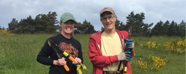
Jeff Roehm with NCLC Project Manager Amy Hutmacher
Comments
Hi Jeff. I just received your discovery from my son, John. This is so exciting & interesting to know. I do have fond memories of you & your twin brother in my wedding & how special that was. My father, Oney was a wonderful man & well respected by many. Thank you so much for putting this all together. Sandra