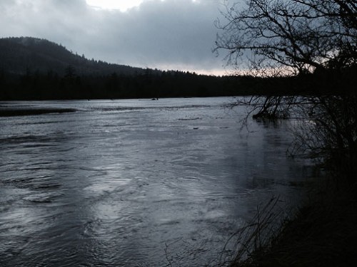
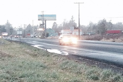
It’s been an exciting weather weekend, which makes this a good time to share with you and clarify what’s going on in regard to road flooding in and around Seaside. You probably saw the reports (or maybe experienced it for yourself) that Highway 101 was closed early Monday morning. Well, it was closed near the junction with U.S. 26, a point that historically floods only when we have an extreme amount of rainfall in a short period. Prior to last fall’s removal of the river levee on North Coast Land Conservancy’s Circle Creek Habitat Reserve along the Necanicum River a mile to the north, highway flooding at the junction meant there was going to be a closure near Circle Creek that could last for days. What happened this time? The highway was clear and open and continues to be, and the Necanicum River is running free over its floodplain. When NCLC Administrative Assistant Allison Wilski, who lives in Gearhart, arrived in Cannon Beach Monday evening for a practice session with the Cannon Beach Chorus, her fellow chorus members thanked her profusely for the floodplain restoration work that North Coast Land Conservancy had accomplished; it was what enabled all the chorus members to get to the practice! I’d like to pass the thank yous on a bit further: this effort was truly a community collaboration. With the County as a lead planner and project manager for the levee removal and the continued data collection, and ODOT’s wetlands mitigation funding and planning, North Coast Land Conservancy was just one important part of this all happening.
 When Clatsop County first created the community consortium to address the chronic Highway 101 flooding problem, which led to the collaboration between the Oregon Department of Transportation, the County, and North Coast Land Conservancy, none of us knew for sure how it would turn out, but we all put our heads together to come up with a project that would be of great benefit to both people and the land. As we’ve now seen for ourselves more than once this winter, it worked. It can be hard to tell if something worked when the result you’re seeking is “nothing,”—meaning, no water on the highway—which is why I’m hoping this story can get out. With the highway remaining open at the project site even during a period that saw multiple inches of rainfall, we now know for certain how effective restoration of natural floodplain dynamics can be in solving infrastructure flooding problems. And as I drove home from work this evening, passing this area of the Necanicum floodplain, the river was spilling out over its banks, filling the wetlands and eddies, providing an incredible lift to the ecology of the area, with beautiful flocks of geese and waterfowl soaring overhead and dabbling at the edges: that’s a whole lot of “nothing” that happened!
This week wasn’t the first test of the floodplain project. Just days ago, Vaughn Collins with Northwest Hydraulic Consultants, an independent consultant working with Clatsop County, released a draft of a study comparing the September 2013 flood event to previous flood events of similar magnitude at the same site, in order to evaluate whether or not the highway would have flooded in the September event had the floodplain restoration project not taken place. He determined that the highway would have flooded, twice, with about one foot of water on the road, had the project not taken place before the flood. He estimates that the water levels on the east side of the highway were reduced by about 1.2 to 1.8 feet because of this project. Pretty cool! In another month or so, after the County checks all the gauges and collects the data, we will be able to estimate how much flooding on the highway would likely have occurred during this weekend’s high rainfall had we not done the floodplain restoration project.
We will never know exactly how many people made it to chorus or baseball practice, to the hospital emergency room or work because of the project, or how many little fishes found refuge from the fast flowing waters of the river, or how many birds found their dinner last night in the floodplain waters, but we and our partners at ODOT and Clatsop County are glad they did.
Katie Voelke
Executive Director, North Coast Land Conservancy

Comments