DOWNLOAD MAP
The public is allowed to visit the Rainforest Reserve for non-motorized recreation such as hiking; hunting (of deer and elk only); and fishing (following state fish and game regulations). Note that the summit of Onion Peak is off-limits to the public due to the sensitive plant and animal species there (see map).
In Summer 2021, North Coast Land Conservancy began a planning process to determine the best ways to protect sensitive habitats within the Rainforest Reserve while still allowing public access to less sensitive portions of the Reserve. In the meantime, please follow these guidelines when planning a visit to the Rainforest Reserve:
Public Access on the Rainforest Reserve
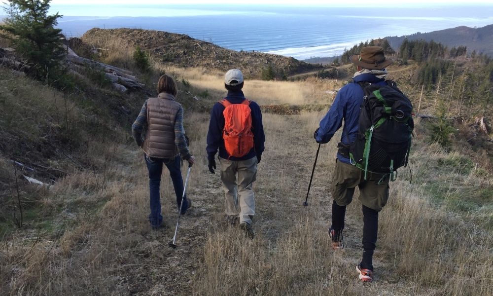
There are two main access points for the Rainforest Reserve from Highway 101 (see map). Both require you to park at a gate and walk a gravel road through privately owned timberlands to reach the Reserve. There is limited parking at either site. Do not block the gate; logging trucks must continue to have access. Do not block the line of sight for safely exiting onto the highway. Do not park on the highway. If the parking is too tight, please return at another time. Watch for logging trucks driving on the roads as you walk, as there may be active logging on adjacent land until you reach the boundary of the Rainforest Reserve.
The Hug Point access allows hikers to approach the Reserve from the north. It requires the longest hike to reach the boundary of the Rainforest Reserve (about 3.4 miles, 1600 feet elevation gain). From this access point it is possible to cross over to land managed by Nuveen Natural Capital (formerly GreenWood Resources). We recommend that you sign up for this permit even if you don’t intend to cross into Nuveen land. By signing up for a permit (available free online), you will receive emails about fire closures and policy changes.
The Falcon Cove access allows hikers to approach the Reserve from the south. It requires a shorter hike to reach the Reserve (about 1 mile, 400 feet elevation gain) and requires you to walk through land owned by Weyerhaeuser. Weyerhaeuser also has a permit system in place, but there is a cost for this permit. A sign posted on the gate at this access indicates that public access is allowed during daylight hours. We recommend consulting the Weyerhaeuser recreation website and obeying the rules posted at the gate.
Both of the access points require you to park at the gate (to the side without blocking the gate). There is limited parking at both sites. There is no planned logging on our land, but there is often active logging on the neighboring properties. Be cautious of the potential for log trucks driving on the roads until you get to the Rainforest Reserve boundary.
Guidelines and Permissible Uses
We welcome visitors to the Rainforest Reserve—a beautiful place that belongs to us all. However, to protect this ecologically sensitive land, we must be good stewards. You can help by following these guidelines within the Rainforest Reserve boundary:
- Foot and bicycle traffic only (No motorized vehicles or e-bikes)
- No trapping or predator hunting
- Horses and other domestic animals are not permitted
- No camping or fires
- Check your boots and clothes to remove invasive plant seeds before proceeding
- No access to Onion Peak
- Stay on the road where indicated
- Respect the land, and leave no trace
Thank you for helping protect this special place!
Comments