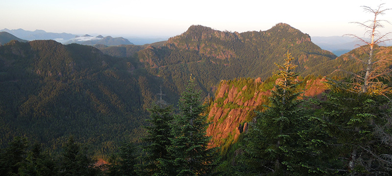
North Coast Land Conservancy’s service area stretches from the Columbia River south to Lincoln County, but a big focus of our work these days is the landscape we call the Coastal Edge: the unique ecosystem lying between Tillamook Head and Nehalem Bay. It is the product of geologic forces at work over millennia. It is the setting for our most ambitious project to date: conservation of the proposed Rainforest Reserve.
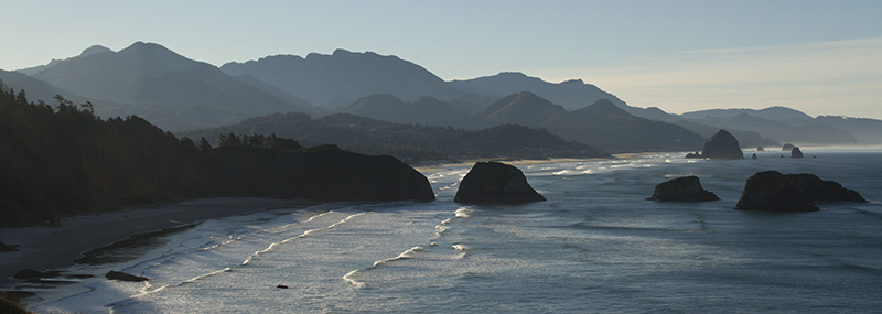
Looking south from Ecola Point north of Cannon Beach, you see the horizon of the Coastal Edge. PHOTO: Neal Maine
From the slope of the mountains to the sediment in the streams, geology influences the habitats and, thus, plants and animals present in the watershed. Here board member and geologist Tom Horning talks about what he sees when he looks at the Coastal Edge.
Angora Peak summit complex. PHOTO: Randall Henderson
Angora Peak and Onion Peak are made up of rocks deposited in the ocean by a river of lava that poured into the ocean off the edge of the continent and were then uplifted by tectonic forces over millions of years. It is what I call inverted topography: lava filled these underwater canyons, creating a ribbon of hard basalt running through softer mudstone and sandstone.
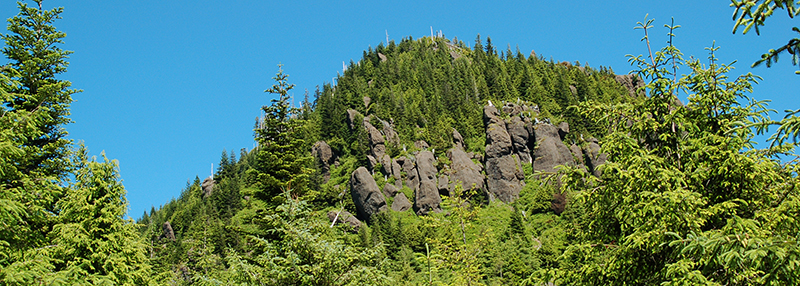
Basalt columns jut up among the trees at the summit of Onion Peak. PHOTO: Mike Patterson
Over time, as the continent’s edge rose, erosion wore away the softer stone and left a series of basalt ridges and peaks running from what is now Angora Peak northeast to Nicolai Mountain near Knappa.
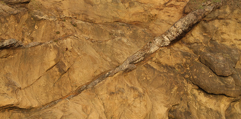
Neal Maine’s photographs of the rocks at Hug Point, at the foot of the Coastal Edge, help illustrate this geology story. Above, a dike of Columbia River basalt cuts through Angora Peak sandstone.
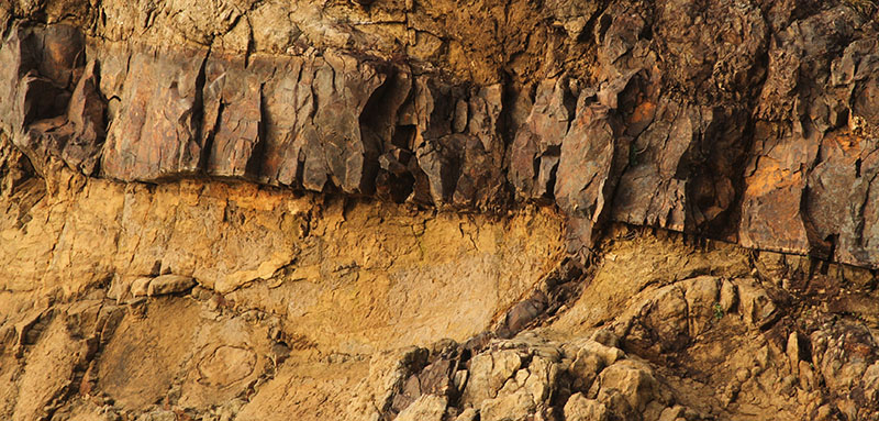
Here a small dike of basalt seeps out from beneath a bigger dike–easily done if the lava is hot and runny.
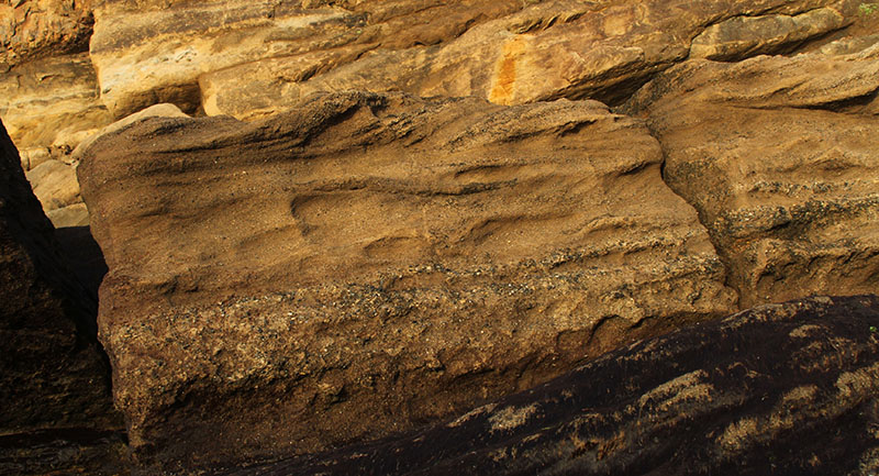
Landslide rubble made of Angora Peak sandstone fills an old gully eroded into the sandstone.
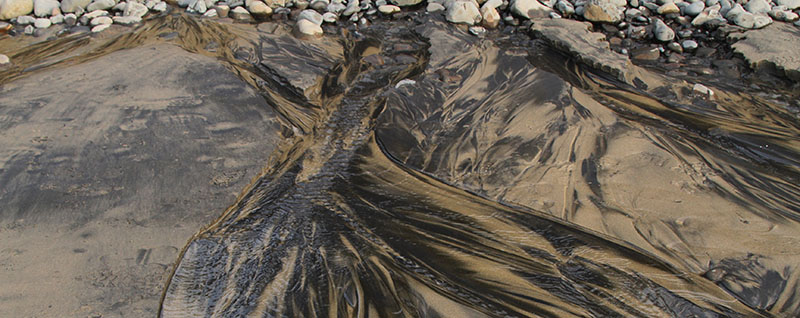
Different heavy minerals in beach sand are segregated by stream currents. Light quartz and feldspar are washed down toward the ocean with magnetite (black) and pyroxene (green-brown).
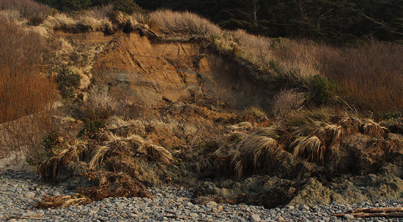
Saturation from heavy rains and big surf cause grasses and clay-silt soils to slump onto the cobble berm atop the beach.
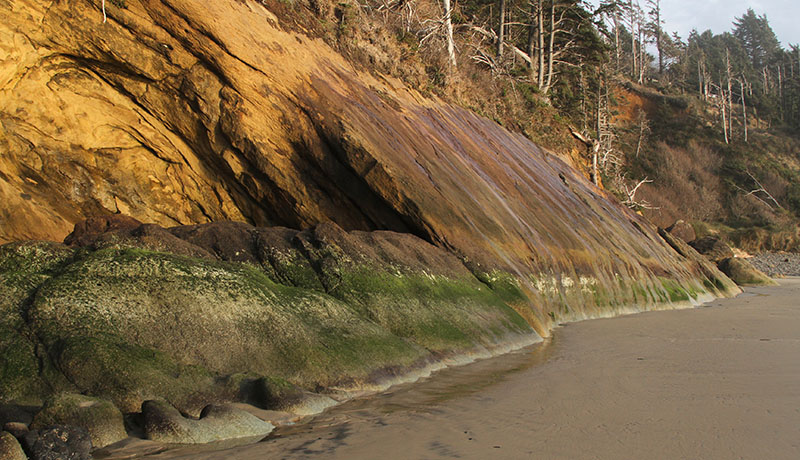
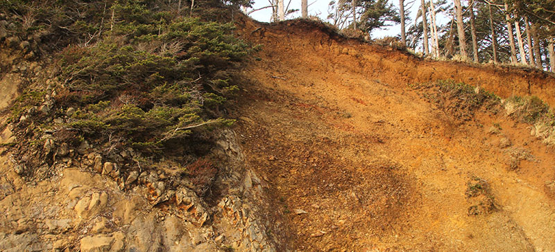
Angora Peak sandstone angles toward the beach, tipped by the invasion of unseen basaltic lavas.
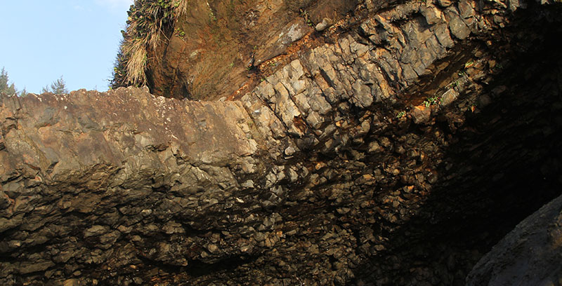
Columnar jointing in a sill of Columbia River basalt is caused by cooling from the edge inward.
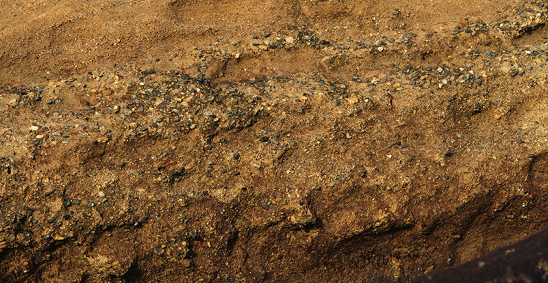
Angora Peak sandstone formed in channels and bars in the ancient Columbia River estuary, when the river emptied into the ocean near modern-day Arch Cape. The sandstone is composed of metamorphic rock that eroded out of the mountains of northern Idaho, Washington, Montana, and British Columbia–the headwaters of the Columbia–and washed into the estuary of the Columbia 15 to 20 million years ago.
White quartzite pebbles and dark cherts are sprinkled about in the golden brown sandstone.
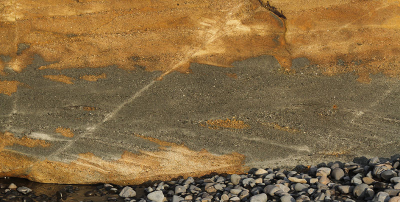
Gray unoxidized sandstone is exposed when the big waves of winter have stripped down the beach. Oxygen from the atmosphere will convert the gray colors to brown if the sand doesn’t cover the outcrop in time.
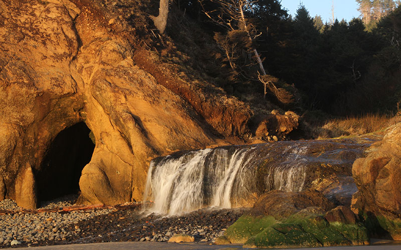
Sea caves form where waves can penetrate weak zones. Air compression helps to blow out pieces of bedrock, and cobbles of hard basalt further grind down the sandstone. Creeks drain where faults cut and weaken the bedrock.
Comments